Geolocate

Viveiro topographic map

Click on the map to display elevation.

About this map
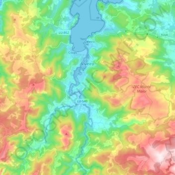
Name: Viveiro topographic map, elevation, terrain.

Location: Viveiro, A Mariña Occidental, Lugo, Galicia, Spain (43.57433 -7.66292 43.71255 -7.47946)

Average elevation: 247 m

Minimum elevation: -4 m

Maximum elevation: 674 m

Other topographic maps

Click on a map to view its topography, its elevation and its terrain.

Lamaboa

Spain > Galicia > A Mariña Occidental > Xove

Average elevation: 123 m

O Foxo

Spain > Galicia > A Mariña Occidental > Ourol

Average elevation: 394 m

As Lobeiras

Spain > Galicia > A Mariña Occidental > Ourol

Average elevation: 429 m

Gear up for your next adventure:

🪑Insulated Seat Pad - Protect your seat from cold rocks and wet logs
🐕Hiking Dog Pack - Let your canine companion carry their own water and food
⛺Backpacking Tent - Lightweight tent for long-distance hiking trips
🧴Outdoor Sunscreen - High SPF protection for high-altitude UV exposure
🥾Mountain Trail Shoes - High-traction shoes for mountain trails

As an Amazon Associate, this site earns from qualifying purchases at no extra cost to you.