Geolocate

Malambo topographic map

Click on the map to display elevation.

About this map

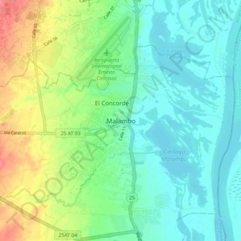
Name: Malambo topographic map, elevation, terrain.

Location: Malambo, Atlántico, RAP Caribe, 083010, Colombia (10.82534 -74.81462 10.90534 -74.73462)

Average elevation: 22 m

Minimum elevation: 0 m

Maximum elevation: 71 m

Gear up for your next adventure:

🧼Travel Hand Sanitizer - Keep hands clean when water is scarce
🥾Trekking Poles - Adjustable trekking poles to reduce knee stress and improve stability
🔦LED Headlamp - Hands-free lighting for early morning starts or late finishes
🚑Survival Whistle - Signal for help across long distances in mountains
🧭GPS Tracker - Track your location in remote areas safely

As an Amazon Associate, this site earns from qualifying purchases at no extra cost to you.