Geolocate

Grapevine topographic map

Click on the map to display elevation.

About this map

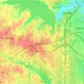
Name: Grapevine topographic map, elevation, terrain.

Location: Grapevine, Tarrant County, Texas, 76051, United States (32.87849 -97.12967 32.99364 -97.01569)

Average elevation: 176 m

Minimum elevation: 140 m

Maximum elevation: 216 m

Gear up for your next adventure:

🎒Backpack Rain Cover - External shield to keep your entire pack dry
🔥Emergency Fire Starter - Reliable ignition source for all weather conditions
🔦UV Flashlight - Detect minerals or specific insects in the dark
👟Trail Running Shoes - Agile footwear for fast-paced topographic exploration
🌡️Emergency Mylar Blankets - Compact thermal protection for unexpected nights outdoors

As an Amazon Associate, this site earns from qualifying purchases at no extra cost to you.