Geolocate

Brampton topographic map

Click on the map to display elevation.

About this map

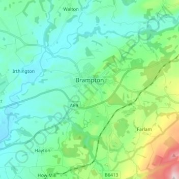
Name: Brampton topographic map, elevation, terrain.

Location: Brampton, Carlisle, Cumbria, England, United Kingdom (54.91187 -2.79749 54.96429 -2.66514)

Average elevation: 96 m

Minimum elevation: 21 m

Maximum elevation: 379 m

Gear up for your next adventure:

🧥Softshell Jacket - Windproof and breathable jacket for hiking
Bushcraft Tarp - Versatile emergency shelter or gear protection
Camping Tent - Weather-resistant tents suitable for 2 to 6 people
🛌Insulated Sleeping Pad - Critical thermal barrier between you and the cold ground
🧭GPS Outdoor Watch - Smart watch for navigation and fitness tracking in nature

As an Amazon Associate, this site earns from qualifying purchases at no extra cost to you.