

Salem topographic map
Click on the map to display elevation.
Salem
Elevation within the city limits ranges from about 120 to 800 feet (37 to 244 m). Salem contains the volcanic Salem Hills in the south and is sandwiched by the 1,000 ft (300 m) Eola Hills directly to the west and the 600 ft (180 m) Waldo Hills to the east. Northern and eastern Salem are less hilly. South and West Salem contain some canyons and are the hilliest areas. The coast range and the Cascades—including Mount Hood, Mount Jefferson, and on the clearest of days, Mount St. Helens and Mount Adams in Washington—can be viewed from throughout the city.
About this map
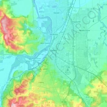
Name: Salem topographic map, elevation, terrain.
Location: Salem, Marion County, Oregon, United States (44.85125 -123.12296 45.01662 -122.93521)
Average elevation: 96 m
Minimum elevation: 30 m
Maximum elevation: 344 m