Geolocate

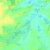
Aulnay topographic map

Click on the map to display elevation.

About this map

Name: Aulnay topographic map, elevation, terrain.

Location: Aulnay, Saint-Jean-d'Angély, Charente-Maritime, Nouvelle-Aquitaine, Metropolitan France, 17470, France (45.98652 -0.39629 46.05194 -0.30102)

Average elevation: 66 m

Minimum elevation: 35 m

Maximum elevation: 111 m

Other topographic maps

Click on a map to view its topography, its elevation and its terrain.
Gear up for your next adventure:

⛺Camping Tent - Weather-resistant tents suitable for 2 to 6 people
🥾Approach Shoes - Shoes designed for climbing approaches and rugged trails
🥾Trekking Boots - Durable boots for long-distance trekking
⛺Bushcraft Tarp - Versatile emergency shelter or gear protection
🥾Waterproof Hiking Boots - Boots keeping your feet dry in wet conditions

As an Amazon Associate, this site earns from qualifying purchases at no extra cost to you.