
Franklin topographic map
Interactive map
Click on the map to display elevation.
About this map
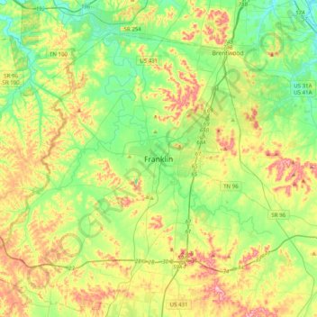
Name: Franklin topographic map, elevation, terrain.
Location: Franklin, Williamson County, Tennessee, 36711, United States (35.76521 -87.02894 36.08521 -86.70894)
Average elevation: 231 m
Minimum elevation: 148 m
Maximum elevation: 377 m
Other topographic maps
Click on a map to view its topography, its elevation and its terrain.
Fort Granger
United States > Tennessee > Williamson County > Franklin
Fort Granger, Rolling Rivers, Franklin, Williamson County, Tennessee, United States
Average elevation: 203 m