
Thank you for supporting this site ❤️
Make a donation
Make a donation
Gear up for your next adventure:
As an Amazon Associate, this site earns from qualifying purchases at no extra cost to you.
Zaio topographic map
Click on the map to display elevation.
Thank you for supporting this site ❤️
Make a donation
Make a donation
Gear up for your next adventure:
As an Amazon Associate, this site earns from qualifying purchases at no extra cost to you.
About this map
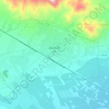
Name: Zaio topographic map, elevation, terrain.
Location: Zaio, Pachalik de Zaio, Nador Province, Oriental, Morocco (34.92394 -2.77205 34.95505 -2.69959)
Average elevation: 233 m
Minimum elevation: 81 m
Maximum elevation: 771 m
Thank you for supporting this site ❤️
Make a donation
Make a donation
Gear up for your next adventure:
As an Amazon Associate, this site earns from qualifying purchases at no extra cost to you.