
Palatka topographic map
Click on the map to display elevation.
Palatka
Palatka is located at 29°38′N 81°39′W / 29.633°N 81.650°W / 29.633; -81.650. The total area is 7.5 square miles (19 km2) and has an average elevation of 16 feet (4.8 m) above sea level. The city is located in the southern portion of the Lower St. Johns River basin.
About this map
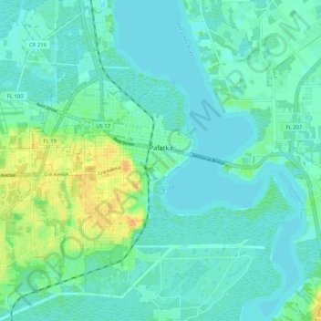
Name: Palatka topographic map, elevation, terrain.
Location: Palatka, Putnam County, Florida, 32177, United States (29.60771 -81.72944 29.68270 -81.62647)
Average elevation: 8 m
Minimum elevation: 0 m
Maximum elevation: 31 m