Geolocate

Cascade Mountain topographic map

Click on the map to display elevation.

About this map
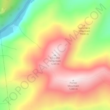
Name: Cascade Mountain topographic map, elevation, terrain.

Location: Cascade Mountain, Keene, Essex County, New York, United States (44.21853 -73.86022 44.21863 -73.86012)

Average elevation: 946 m

Minimum elevation: 609 m

Maximum elevation: 1,226 m

Other topographic maps

Click on a map to view its topography, its elevation and its terrain.
Moriah

United States > New York > Essex County > Moriah

Average elevation: 283 m

Gear up for your next adventure:

🧦Thermal Socks - Warm socks for winter hiking or camping
🦌Outdoor Trail Camera - Monitor wildlife activity near your favorite spots
🥾Lightweight Hiking Shoes - Comfortable shoes for day hikes
🧢Outdoor Visor - Breathable visor for sunny hikes
🧤Insulated Winter Gloves - Heavy-duty protection for sub-zero Canadian adventures

As an Amazon Associate, this site earns from qualifying purchases at no extra cost to you.