
Reykjahlíð topographic map
Interactive map
Click on the map to display elevation.
About this map
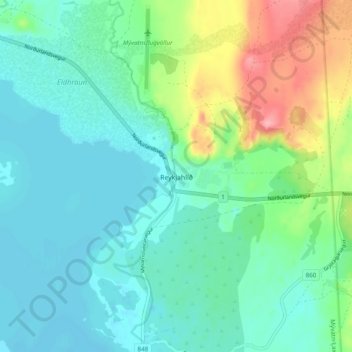
Name: Reykjahlíð topographic map, elevation, terrain.
Location: Reykjahlíð, Skútustaðahreppur, Northeastern Region, Iceland (65.62156 -16.93001 65.66156 -16.89001)
Average elevation: 305 m
Minimum elevation: 276 m
Maximum elevation: 389 m