Geolocate

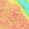
Vauboyen topographic map

Click on the map to display elevation.

About this map

Name: Vauboyen topographic map, elevation, terrain.

Location: Vauboyen, Bièvres, Palaiseau, Essonne, Ile-de-France, Metropolitan France, 91570, France (48.74090 2.17758 48.78090 2.21758)

Average elevation: 143 m

Minimum elevation: 69 m

Maximum elevation: 184 m

Other topographic maps

Click on a map to view its topography, its elevation and its terrain.
Évry

France > Ile-de-France > Essonne

Average elevation: 76 m

Saclay

France > Ile-de-France > Essonne

Average elevation: 148 m

91320

France > Ile-de-France > Essonne > Wissous

Average elevation: 81 m

91730

France > Ile-de-France > Essonne > Chamarande

Average elevation: 132 m

Bures-sur-Yvette

France > Ile-de-France > Essonne

Average elevation: 118 m

Verrières-le-Buisson

France > Ile-de-France > Essonne

Average elevation: 107 m

Gear up for your next adventure:

📷Outdoor Action Camera - Capture high-elevation views and rugged adventures
🦶Hiking Shoe Insoles - Added support for high arches and long days on feet
🔥Camping Stove - Portable stoves to cook outdoors with ease
🧥Waterproof Pants - Keep dry during rainy hiking conditions
🥾Durable Hiking Shoes - Long-lasting shoes for frequent hiking

As an Amazon Associate, this site earns from qualifying purchases at no extra cost to you.