Geolocate

Valangin topographic map

Click on the map to display elevation.

About this map

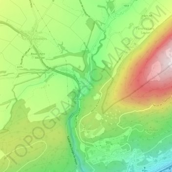
Name: Valangin topographic map, elevation, terrain.

Location: Valangin, Neuchâtel, 2042, Switzerland (46.99585 6.88727 47.03585 6.92727)

Average elevation: 756 m

Minimum elevation: 471 m

Maximum elevation: 1,133 m

Gear up for your next adventure:

🕶️Polarized Sunglasses - Protect your eyes with durable polarized lenses
🔋Lithium AA Batteries - Long-lasting power that performs in extreme cold
Camping Coffee Maker - Brew fresh coffee anywhere on the topographic map
Lightweight Camping Tent - Portable shelter optimized for Canadian backcountry camping
🔦LED Flashlight - Powerful and long-lasting flashlight for camping and emergencies

As an Amazon Associate, this site earns from qualifying purchases at no extra cost to you.