Geolocate

Menomonee Falls topographic map

Click on the map to display elevation.

About this map

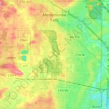
Name: Menomonee Falls topographic map, elevation, terrain.

Location: Menomonee Falls, Waukesha County, Wisconsin, United States (43.10457 -88.18567 43.19261 -88.06336)

Average elevation: 254 m

Minimum elevation: 215 m

Maximum elevation: 302 m

Other topographic maps

Click on a map to view its topography, its elevation and its terrain.

Bowron Lake

United States > Wisconsin > Waukesha County > Summit

Average elevation: 269 m

Gear up for your next adventure:

🕯️Camping Lantern - Illuminates your entire campsite with high-efficiency LEDs
💡LED Headlamp - Hands-free illumination for night hiking and camping
🥾Hiking Shorts - Breathable shorts suitable for summer hikes
🔪Outdoor Multitool - Versatile tool for repairs and food prep in the wild
💡Portable Camping Lamp - Rechargeable lamp for campsite lighting

As an Amazon Associate, this site earns from qualifying purchases at no extra cost to you.