Geolocate

Passo di Riva topographic map

Click on the map to display elevation.

About this map
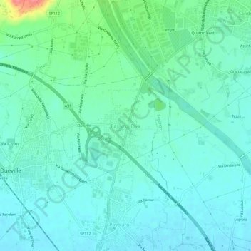
Name: Passo di Riva topographic map, elevation, terrain.

Location: Passo di Riva, Dueville, Vicenza, Veneto, 36031, Italy (45.62266 11.55482 45.66266 11.59482)

Average elevation: 61 m

Minimum elevation: 45 m

Maximum elevation: 124 m

Gear up for your next adventure:

⛺Backpacking Tent - Lightweight tent for long-distance hiking trips
🥾Hiking Leggings - Comfortable leggings for outdoor activities
🧴Sunscreen SPF - Broad-spectrum sunscreen for outdoor activities
⛺Camping Tent - Weather-resistant tents suitable for 2 to 6 people
🥾Light Trekking Boots - Supportive boots for multi-day treks

As an Amazon Associate, this site earns from qualifying purchases at no extra cost to you.