Geolocate

Ward 5 topographic map

Click on the map to display elevation.

About this map

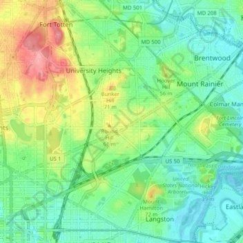
Name: Ward 5 topographic map, elevation, terrain.

Location: Ward 5, Washington, District of Columbia, United States (38.89708 -77.01926 38.95727 -76.94191)

Average elevation: 35 m

Minimum elevation: -4 m

Maximum elevation: 105 m

Other topographic maps

Click on a map to view its topography, its elevation and its terrain.

Gear up for your next adventure:

🧦Hiking Socks - Moisture-wicking and comfortable socks for long hikes
🔭Compact Binoculars - Lightweight optics for scouting trails and wildlife
💡LED Headlamp - Hands-free illumination for night hiking and camping
🧤Insulated Winter Gloves - Heavy-duty protection for sub-zero Canadian adventures
🛶Canoe Life Vest - Safety vest for water sports

As an Amazon Associate, this site earns from qualifying purchases at no extra cost to you.