Geolocate

Heybeliada topographic map

Click on the map to display elevation.

About this map
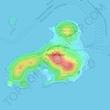
Name: Heybeliada topographic map, elevation, terrain.

Location: Heybeliada, Prince Islands, Istanbul, Marmara Region, 34973, Turkey (40.86740 29.07471 40.88482 29.10415)

Average elevation: 11 m

Minimum elevation: -2 m

Maximum elevation: 130 m

Other topographic maps

Click on a map to view its topography, its elevation and its terrain.
Büyükada Island

Turkey > Prince Islands

Average elevation: 20 m

Gear up for your next adventure:

🕯️Camping Lantern - Illuminates your entire campsite with high-efficiency LEDs
🥽Outdoor Goggles - Protective eyewear for outdoor activities
🔭Compact Binoculars - Lightweight optics for scouting trails and wildlife
🧢Sun Protection Cap - Breathable cap to protect from sun exposure
📷Outdoor Action Camera - Capture high-elevation views and rugged adventures

As an Amazon Associate, this site earns from qualifying purchases at no extra cost to you.