
Thank you for supporting this site ❤️
Make a donation
Make a donation
Gear up for your next adventure:
As an Amazon Associate, this site earns from qualifying purchases at no extra cost to you.
Cheoin-gu topographic map
Click on the map to display elevation.
Thank you for supporting this site ❤️
Make a donation
Make a donation
Gear up for your next adventure:
As an Amazon Associate, this site earns from qualifying purchases at no extra cost to you.
About this map
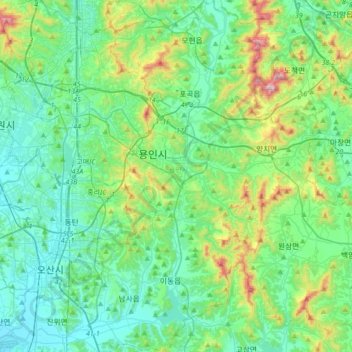
Name: Cheoin-gu topographic map, elevation, terrain.
Location: Cheoin-gu, Yongin-si, Gyeonggi, South Korea (37.08464 127.10888 37.36042 127.42993)
Average elevation: 136 m
Minimum elevation: 8 m
Maximum elevation: 609 m
Thank you for supporting this site ❤️
Make a donation
Make a donation
Gear up for your next adventure:
As an Amazon Associate, this site earns from qualifying purchases at no extra cost to you.