Geolocate

Roanne topographic map

Click on the map to display elevation.

About this map
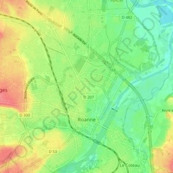
Name: Roanne topographic map, elevation, terrain.

Location: Roanne, Loire, Auvergne-Rhône-Alpes, Metropolitan France, 42300, France (46.01808 4.04673 46.07143 4.11380)

Average elevation: 282 m

Minimum elevation: 254 m

Maximum elevation: 321 m

Other topographic maps

Click on a map to view its topography, its elevation and its terrain.

Villette

France > Auvergne-Rhône-Alpes > Loire > Noirétable

Average elevation: 742 m

Gear up for your next adventure:

🚲Handlebar Phone Mount - View topographic-map.com live while cycling
🧰Emergency Multi-Tool - Compact multi-tool for outdoor survival
💡Solar Camping Lamp - Eco-friendly lighting for campsites
🧳Compression Sacks - Maximize space in your backpack by shrinking gear
🎒Backpack Rain Cover - External shield to keep your entire pack dry

As an Amazon Associate, this site earns from qualifying purchases at no extra cost to you.