Geolocate

Arak topographic map

Click on the map to display elevation.

About this map

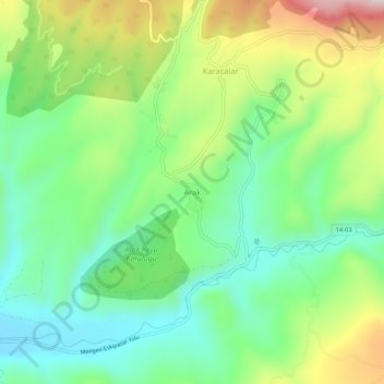
Name: Arak topographic map, elevation, terrain.

Location: Arak, Mengen, Bolu, Black Sea Region, Turkey (40.92575 32.21861 40.96575 32.25861)

Average elevation: 871 m

Minimum elevation: 723 m

Maximum elevation: 1,140 m

Gear up for your next adventure:

🦶Hiking Shoe Insoles - Added support for high arches and long days on feet
🥾Hiking Shorts - Breathable shorts suitable for summer hikes
🎒Fully Waterproof Backpack - Total protection for photography gear and electronics
❄️Traction Ice Cleats - Slip-on spikes for icy trails and winter hiking
🥾Waterproof Trail Shoes - Shoes designed to handle wet terrain

As an Amazon Associate, this site earns from qualifying purchases at no extra cost to you.