Geolocate

Lindau (Bodensee) topographic map

Click on the map to display elevation.

About this map
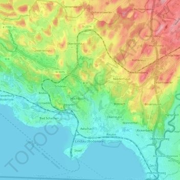
Name: Lindau (Bodensee) topographic map, elevation, terrain.

Location: Lindau (Bodensee), Landkreis Lindau, Bavaria, 88131, Germany (47.53366 9.63623 47.61207 9.74084)

Average elevation: 448 m

Minimum elevation: 391 m

Maximum elevation: 561 m

Gear up for your next adventure:

🧢Sun Protection Cap - Breathable cap to protect from sun exposure
🎒Hiking Backpack - Lightweight and ergonomic backpacks for day hikes or multi-day treks
⛺Camping Groundsheet - Protect your tent from moisture and dirt
🧭GPS Tracker - Track your location in remote areas safely
🔨Vehicle Emergency Tool - Safety tool for remote road trips to trailheads

As an Amazon Associate, this site earns from qualifying purchases at no extra cost to you.