Geolocate

Nacka kommun topographic map

Click on the map to display elevation.

About this map

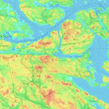
Name: Nacka kommun topographic map, elevation, terrain.

Location: Nacka kommun, Stockholm County, Sweden (59.23148 18.10535 59.36930 18.38891)

Average elevation: 24 m

Minimum elevation: -2 m

Maximum elevation: 87 m

Other topographic maps

Click on a map to view its topography, its elevation and its terrain.

Boo

Sweden > Stockholm County

Average elevation: 23 m

Gear up for your next adventure:

🔥Emergency Fire Starter - Reliable ignition source for all weather conditions
🚲Handlebar Phone Mount - View topographic-map.com live while cycling
🧶550 Survival Paracord - Versatile utility cord for emergency repairs and rigging
💡Solar Camping Lamp - Eco-friendly lighting for campsites
🧦Hiking Socks - Moisture-wicking and comfortable socks for long hikes

As an Amazon Associate, this site earns from qualifying purchases at no extra cost to you.