Geolocate

Jibhi topographic map

Click on the map to display elevation.

About this map
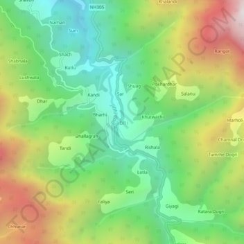
Name: Jibhi topographic map, elevation, terrain.

Location: Jibhi, Banjar, Kullu, Himachal Pradesh, 175123, India (31.57228 77.33262 31.61228 77.37262)

Average elevation: 2,242 m

Minimum elevation: 1,565 m

Maximum elevation: 3,319 m

Gear up for your next adventure:

🧢Outdoor Visor - Breathable visor for sunny hikes
🏃Hydration Running Vest - Carry water and maps close to your body for speed
🧼Biodegradable Camp Soap - Environmentally friendly cleaning for gear and body
🔋Solar Power Bank - Keep your GPS and devices charged during long outdoor trips
❄️Traction Ice Cleats - Slip-on spikes for icy trails and winter hiking

As an Amazon Associate, this site earns from qualifying purchases at no extra cost to you.