Geolocate

Leiro topographic map

Click on the map to display elevation.

About this map
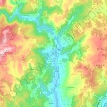
Name: Leiro topographic map, elevation, terrain.

Location: Leiro, O Ribeiro, Ourense, Galicia, Spain (42.33532 -8.21729 42.40400 -8.09979)

Average elevation: 307 m

Minimum elevation: 76 m

Maximum elevation: 631 m

Other topographic maps

Click on a map to view its topography, its elevation and its terrain.

Berán

Spain > Galicia > O Ribeiro > Leiro

Average elevation: 243 m

Gear up for your next adventure:

⛺Backpacking Tent - Lightweight tent for long-distance hiking trips
🚲Bike Repair Kit - Essential tools for on-trail mechanical issues
🧢Sun Hat - Wide-brim hat for sun protection
🧥Waterproof Pants - Keep dry during rainy hiking conditions
🛰️Satellite Messenger - Emergency communication for areas with no cell service

As an Amazon Associate, this site earns from qualifying purchases at no extra cost to you.