Geolocate

Adorf topographic map

Click on the map to display elevation.

About this map
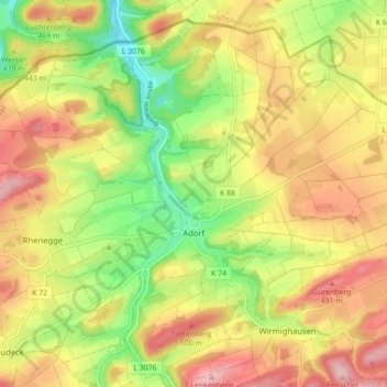
Name: Adorf topographic map, elevation, terrain.

Location: Adorf, Diemelsee, Landkreis Waldeck-Frankenberg, Hesse, Germany (51.34113 8.77833 51.39065 8.86622)

Average elevation: 418 m

Minimum elevation: 313 m

Maximum elevation: 518 m

Other topographic maps

Click on a map to view its topography, its elevation and its terrain.
Gear up for your next adventure:

🧥Softshell Jacket - Windproof and breathable jacket for hiking
🎒Hiking Daypack - Lightweight and durable backpacks for day trips and excursions
🛌Down Sleeping Bag - Superior warmth-to-weight ratio for cold nights
🧦Outdoor Socks - Durable socks designed for hiking and outdoor sports
🥾Mountain Hiking Shoes - Shoes with superior grip for mountainous terrain

As an Amazon Associate, this site earns from qualifying purchases at no extra cost to you.