Geolocate

Bailey Hall topographic map

Click on the map to display elevation.

About this map
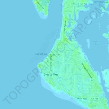
Name: Bailey Hall topographic map, elevation, terrain.

Location: Bailey Hall, Siesta Key, Sarasota County, Florida, 34242, United States (27.26338 -82.58288 27.30338 -82.54288)

Average elevation: 2 m

Minimum elevation: -1 m

Maximum elevation: 16 m

Other topographic maps

Click on a map to view its topography, its elevation and its terrain.
Gear up for your next adventure:

🥾Mountain Hiking Shoes - Shoes with superior grip for mountainous terrain
🧴Waterproofing Spray - Restore the DWR coating on jackets and tents
🧊Insulated Water Bottle - Keeps drinks cold in summer and prevents freezing in winter
🥾Hiking Leggings - Comfortable leggings for outdoor activities
🎒Fully Waterproof Backpack - Total protection for photography gear and electronics

As an Amazon Associate, this site earns from qualifying purchases at no extra cost to you.