Geolocate

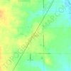
Clearwater topographic map

Click on the map to display elevation.

About this map

Name: Clearwater topographic map, elevation, terrain.

Location: Clearwater, Ninnescah Township, Sedgwick County, Kansas, United States (37.48837 -97.51515 37.54504 -97.47973)

Average elevation: 394 m

Minimum elevation: 379 m

Maximum elevation: 413 m

Other topographic maps

Click on a map to view its topography, its elevation and its terrain.
Murray Gill

United States > Kansas > Sedgwick County

Average elevation: 395 m

County Acres

United States > Kansas > Sedgwick County > Wichita

Average elevation: 407 m

Furley

United States > Kansas > Sedgwick County

Average elevation: 426 m

Sand Burr Hill

United States > Kansas > Sedgwick County > Wichita

Average elevation: 385 m

Midland Park

United States > Kansas > Sedgwick County > Wichita

Average elevation: 387 m

The Hawthorne

United States > Kansas > Sedgwick County > Wichita

Average elevation: 418 m

Gear up for your next adventure:

🥾Lightweight Hiking Boots - Boots for comfort and mobility on long hikes
🧴Insect Repellent - Protect yourself from bugs during outdoor adventures
👖Convertible Hiking Pants - Zip-off legs to adapt to changing weather conditions
🧢Beanie Hat - Keep your head warm in cold weather
🦌Outdoor Trail Camera - Monitor wildlife activity near your favorite spots

As an Amazon Associate, this site earns from qualifying purchases at no extra cost to you.