
Thank you for supporting this site ❤️
Make a donation
Make a donation
Gear up for your next adventure:
As an Amazon Associate, this site earns from qualifying purchases at no extra cost to you.
Kirchheim topographic map
Click on the map to display elevation.
Thank you for supporting this site ❤️
Make a donation
Make a donation
Gear up for your next adventure:
As an Amazon Associate, this site earns from qualifying purchases at no extra cost to you.
About this map
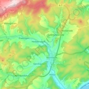
Name: Kirchheim topographic map, elevation, terrain.
Location: Kirchheim, Landkreis Hersfeld-Rotenburg, Hesse, 36275, Germany (50.80734 9.49479 50.89058 9.63022)
Average elevation: 357 m
Minimum elevation: 206 m
Maximum elevation: 635 m
Thank you for supporting this site ❤️
Make a donation
Make a donation
Gear up for your next adventure:
As an Amazon Associate, this site earns from qualifying purchases at no extra cost to you.