
Thank you for supporting this site ❤️
Make a donation
Make a donation
Gear up for your next adventure:
As an Amazon Associate, this site earns from qualifying purchases at no extra cost to you.
Papallacta topographic map
Click on the map to display elevation.
Thank you for supporting this site ❤️
Make a donation
Make a donation
Gear up for your next adventure:
As an Amazon Associate, this site earns from qualifying purchases at no extra cost to you.
About this map
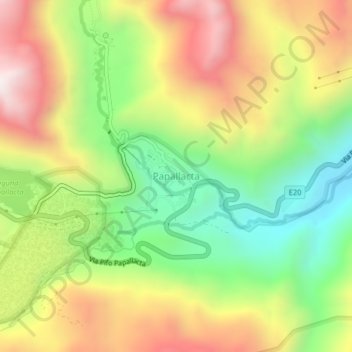
Name: Papallacta topographic map, elevation, terrain.
Location: Papallacta, Cantón Quijos, Napo, Ecuador (-0.39768 -78.16089 -0.35768 -78.12089)
Average elevation: 3,405 m
Minimum elevation: 2,927 m
Maximum elevation: 3,954 m
Thank you for supporting this site ❤️
Make a donation
Make a donation
Gear up for your next adventure:
As an Amazon Associate, this site earns from qualifying purchases at no extra cost to you.