

Mexico City topographic map
Click on the map to display elevation.
Mexico City
Mexico City is located in the Valley of Mexico, sometimes called the Basin of Mexico. This valley is located in the Trans-Mexican Volcanic Belt in the high plateaus of south-central Mexico. It has a minimum altitude of 2,200 meters (7,200 feet) above sea level and is surrounded by mountains and volcanoes that reach elevations of over 5,000 meters (16,000 feet). This valley has no natural drainage outlet for the waters that flow from the mountainsides, making the city vulnerable to flooding. Drainage was engineered through the use of canals and tunnels starting in the 17th century.
About this map
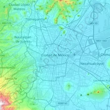
Name: Mexico City topographic map, elevation, terrain.
Location: Mexico City, Cuauhtémoc, Mexico City, 06060, Mexico (19.27260 -99.29334 19.59260 -98.97334)
Average elevation: 2,321 m
Minimum elevation: 2,223 m
Maximum elevation: 3,508 m