Geolocate

Tibú topographic map

Click on the map to display elevation.

About this map

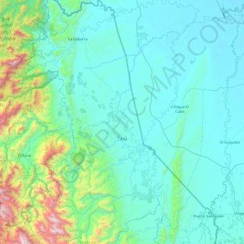
Name: Tibú topographic map, elevation, terrain.

Location: Tibú, Norte, Norte de Santander, RAP Gran Santander, Colombia (8.25180 -73.07414 9.14055 -72.46840)

Average elevation: 268 m

Minimum elevation: 3 m

Maximum elevation: 2,204 m

Gear up for your next adventure:

🎒Hiking Daypack - Lightweight and durable backpacks for day trips and excursions
🛌Insulated Sleeping Pad - Critical thermal barrier between you and the cold ground
📷Outdoor Action Camera - Capture high-elevation views and rugged adventures
🥫Freeze-Dried Meals - Lightweight, high-calorie nutrition for multi-day treks
🧳Compression Sacks - Maximize space in your backpack by shrinking gear

As an Amazon Associate, this site earns from qualifying purchases at no extra cost to you.