Geolocate

Basin topographic map

Click on the map to display elevation.

About this map

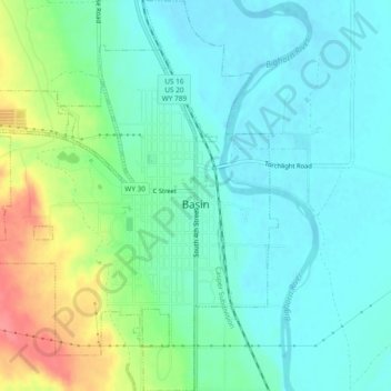
Name: Basin topographic map, elevation, terrain.

Location: Basin, Big Horn County, Wyoming, 82410, United States (44.36395 -108.06835 44.39745 -108.02908)

Average elevation: 1,188 m

Minimum elevation: 1,166 m

Maximum elevation: 1,244 m

Gear up for your next adventure:

🥾Waterproof Hiking Boots - Essential footwear for rugged terrain and wet Canadian trails
🥾Trail Hiking Shoes - Durable shoes designed for rugged trails
🥾Light Hiking Boots - Lightweight and comfortable boots for day hikes
🐕Hiking Dog Pack - Let your canine companion carry their own water and food
🧦Outdoor Socks - Durable socks designed for hiking and outdoor sports

As an Amazon Associate, this site earns from qualifying purchases at no extra cost to you.