
City of Hudson topographic map
Interactive map
Click on the map to display elevation.
About this map
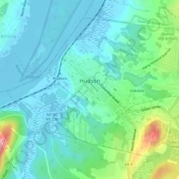
Name: City of Hudson topographic map, elevation, terrain.
Location: City of Hudson, Columbia County, New York, United States (42.23934 -73.80997 42.26355 -73.76811)
Average elevation: 29 m
Minimum elevation: -3 m
Maximum elevation: 130 m
Other topographic maps
Click on a map to view its topography, its elevation and its terrain.
Ghent
United States > New York > Columbia County > Ghent
Ghent, Columbia County, New York, United States
Average elevation: 136 m