
Iredell County topographic map
Interactive map
Click on the map to display elevation.
About this map
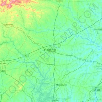
Name: Iredell County topographic map, elevation, terrain.
Location: Iredell County, North Carolina, United States (35.48927 -81.10951 36.05881 -80.69320)
Average elevation: 276 m
Minimum elevation: 193 m
Maximum elevation: 794 m