Geolocate

Beer topographic map

Click on the map to display elevation.

About this map

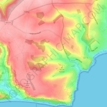
Name: Beer topographic map, elevation, terrain.

Location: Beer, East Devon, Devon, England, United Kingdom (50.68497 -3.13036 50.71918 -3.08420)

Average elevation: 88 m

Minimum elevation: 0 m

Maximum elevation: 155 m

Gear up for your next adventure:

🌡️Emergency Mylar Blankets - Compact thermal protection for unexpected nights outdoors
🥾Lightweight Hiking Boots - Boots for comfort and mobility on long hikes
🧣Evaporative Cooling Towel - Beat the heat during intense summer climbs
🍽️Titanium Camping Spork - Ultralight and indestructible eating utensil
🧤Insulated Winter Gloves - Heavy-duty protection for sub-zero Canadian adventures

As an Amazon Associate, this site earns from qualifying purchases at no extra cost to you.