Geolocate

Palacio topographic map

Click on the map to display elevation.

About this map
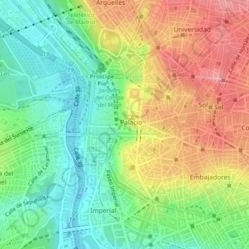
Name: Palacio topographic map, elevation, terrain.

Location: Palacio, Centro, Madrid, Community of Madrid, Spain (40.40669 -3.72291 40.42339 -3.70610)

Average elevation: 626 m

Minimum elevation: 577 m

Maximum elevation: 687 m

Other topographic maps

Click on a map to view its topography, its elevation and its terrain.
Madrid

Spain > Community of Madrid > Madrid

Average elevation: 650 m

Gear up for your next adventure:

🔭Compact Monocular - One-handed bird watching and trail spotting
🧤Thermal Hiking Gloves - Grip-enhanced gloves for cold-weather altitude trekking
🧦Outdoor Socks - Durable socks designed for hiking and outdoor sports
🕶️Polarized Sunglasses - Reduces glare from snow and water at high elevations
🥾Trekking Boots - Durable boots for long-distance trekking

As an Amazon Associate, this site earns from qualifying purchases at no extra cost to you.