Montefrío topographic map
Click on the map to display elevation.
Montefrío
Montefrío is in the northwest of the province of Granada, situated in the region of Loja. The township occupies about 254 km2 and has a density of 25.37 inhabitants / km ². Its geographical coordinates are 37 ° 19 'N, 04 ° 01' W. It is situated at an altitude of 834 m and 57 km from the capital of Granada. Montefrio is limited on the north with the municipalities of Priego de Córdoba and Almedinilla (Córdoba) and Alcalá la Real (Jaén); the southeast with íllora, on the south by Villanueva Mesia and Stump; and on the southwest by Loja and Algarinejo, the latter belonging to the province of Granada.
About this map
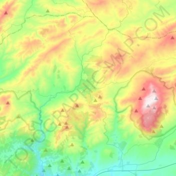
Name: Montefrío topographic map, elevation, terrain.
Location: Montefrío, Comarca de Loja, Granada, Andalusia, 18270, Spain (37.24157 -4.16231 37.40628 -3.91943)
Average elevation: 895 m
Minimum elevation: 514 m
Maximum elevation: 1,590 m
Other topographic maps
Click on a map to view its topography, its elevation and its terrain.