Geolocate

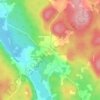
Kingston topographic map

Click on the map to display elevation.

About this map

Name: Kingston topographic map, elevation, terrain.

Location: Kingston, Kingston Parish, Fundy Rural District, Kings County, New Brunswick, E5N 1V3, Canada (45.45576 -66.05697 45.60311 -65.86241)

Average elevation: 62 m

Minimum elevation: -7 m

Maximum elevation: 199 m

Other topographic maps

Click on a map to view its topography, its elevation and its terrain.
Gear up for your next adventure:

🥽Outdoor Goggles - Protective eyewear for outdoor activities
🧢Outdoor Visor - Breathable visor for sunny hikes
🪑Ultralight Camping Stool - Compact seating for rest stops during long hikes
⛺Camping Groundsheet - Protect your tent from moisture and dirt
🥾Trail Hiking Shoes - Durable shoes designed for rugged trails

As an Amazon Associate, this site earns from qualifying purchases at no extra cost to you.