Geolocate

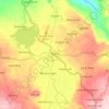
Tubod topographic map

Click on the map to display elevation.

About this map

Name: Tubod topographic map, elevation, terrain.

Location: Tubod, Lanao del Norte, Northern Mindanao, 9209, Philippines (8.00866 123.75618 8.08866 123.83618)

Average elevation: 23 m

Minimum elevation: 0 m

Maximum elevation: 326 m

Other topographic maps

Click on a map to view its topography, its elevation and its terrain.
Agus River

Philippines > Lanao del Norte

Average elevation: 499 m

Linamon

Philippines > Lanao del Norte

Average elevation: 44 m

Kolambugan

Philippines > Lanao del Norte

Average elevation: 55 m

Baloi

Philippines > Lanao del Norte > Baloi

Average elevation: 393 m

Agus River

Philippines > Lanao del Norte > West Pantar

Average elevation: 536 m

Linamon

Philippines > Lanao del Norte

Average elevation: 44 m

Gear up for your next adventure:

🧦Hiking Socks - Moisture-wicking and comfortable socks for long hikes
⛺Tent Footprint - Protect tent floor and increase durability
🥾Lightweight Hiking Shoes - Comfortable shoes for day hikes
🧴Outdoor Sunscreen - High SPF protection for high-altitude UV exposure
🔭Compact Monocular - One-handed bird watching and trail spotting

As an Amazon Associate, this site earns from qualifying purchases at no extra cost to you.