Geolocate

Belleherbe topographic map

Click on the map to display elevation.

About this map
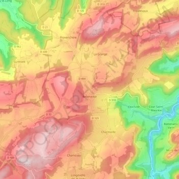
Name: Belleherbe topographic map, elevation, terrain.

Location: Belleherbe, Montbéliard, Doubs, Bourgogne – Franche-Comté, Metropolitan France, 25380, France (47.23900 6.59352 47.29291 6.71271)

Average elevation: 691 m

Minimum elevation: 416 m

Maximum elevation: 876 m

Other topographic maps

Click on a map to view its topography, its elevation and its terrain.
Gear up for your next adventure:

🔦LED Headlamp - Hands-free lighting for early morning starts or late finishes
⛺Camping Essentials - All-in-one gear for a comfortable camping trip
🧢Outdoor Cap - Protective cap for sun and rain during hikes
🛶Kayak Dry Bag - Waterproof storage for kayaking adventures
⛺Camping Groundsheet - Protect your tent from moisture and dirt

As an Amazon Associate, this site earns from qualifying purchases at no extra cost to you.