Geolocate

Saül topographic map

Click on the map to display elevation.

About this map
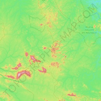
Name: Saül topographic map, elevation, terrain.

Location: Saül, Saint-Laurent-du-Maroni, French Guiana, 97314, France (3.23281 -53.78041 4.40653 -53.09265)

Average elevation: 161 m

Minimum elevation: 17 m

Maximum elevation: 805 m

Other topographic maps

Click on a map to view its topography, its elevation and its terrain.

Fedi

France > French Guiana > Apatou

Average elevation: 31 m

Saint Joseph Island

France > French Guiana > Cayenne

Average elevation: 1 m

Devil's Island

France > French Guiana > Cayenne

Average elevation: 1 m

Crique Paracou

France > French Guiana > Sinnamary

Average elevation: 5 m

Tampok

France > French Guiana

Average elevation: 154 m

Lawa

France > French Guiana > Maripasoula

Average elevation: 110 m

Montagne d'Argent

France > French Guiana > Ouanary

Average elevation: 9 m

Dobai

France > French Guiana > Grand-Santi

Average elevation: 39 m

Lawa

France > French Guiana > Maripasoula

Average elevation: 110 m

Gear up for your next adventure:

🧢Sun Protection Cap - Breathable cap to protect from sun exposure
🚲MTB Frame Bag - Carry tools and maps directly on your bicycle frame
🥾Light Hiking Boots - Lightweight and comfortable boots for day hikes
🧴Bear Spray Holster - Quick-access carry for essential Canadian wilderness safety
🧰Emergency Multi-Tool - Compact multi-tool for outdoor survival

As an Amazon Associate, this site earns from qualifying purchases at no extra cost to you.