
Thank you for supporting this site ❤️
Make a donation
Make a donation
Gear up for your next adventure:
As an Amazon Associate, this site earns from qualifying purchases at no extra cost to you.
Bouira topographic map
Click on the map to display elevation.
Thank you for supporting this site ❤️
Make a donation
Make a donation
Gear up for your next adventure:
As an Amazon Associate, this site earns from qualifying purchases at no extra cost to you.
About this map
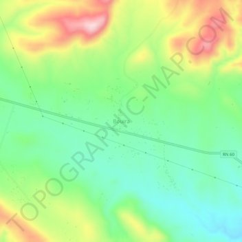
Name: Bouira topographic map, elevation, terrain.
Location: Bouira, Hammam Dhalaa, Hammam Delaa District, M'Sila, Algeria (35.93164 4.29854 35.97164 4.33854)
Average elevation: 892 m
Minimum elevation: 784 m
Maximum elevation: 1,073 m
Thank you for supporting this site ❤️
Make a donation
Make a donation
Gear up for your next adventure:
As an Amazon Associate, this site earns from qualifying purchases at no extra cost to you.