Goslar topographic map
Click on the map to display elevation.
Goslar
Goslar is situated in the middle of the upper half of Germany, about 40 kilometres (25 miles) south of Brunswick and about 70 km (43 mi) southeast of the state capital, Hanover. The Schalke mountain is the highest elevation within the municipal boundaries at 762 metres (2,500 feet). The lowest point of 175 m (574 ft) is near the Oker river. Geographically, Goslar forms the boundary between the Hildesheim Börde which is part of the Northern German Plain, and the Harz range, which is the highest, northernmost extension of Germany's Central Uplands. The Hildesheim Börde is characterised by plains with rich clay soils – used agriculturally for sugar beet farming – interlaced with several hill ranges commonly known as the Hildesheim Forest and Salzgitter Hills. In the northeast the Harly Forest stretches down to the River Oker, in the east, Goslar borders on the German state of Saxony-Anhalt.
About this map
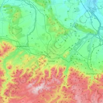
Name: Goslar topographic map, elevation, terrain.
Location: Goslar, Landkreis Goslar, Lower Saxony, Germany (51.84398 10.31590 52.00593 10.65119)
Average elevation: 312 m
Minimum elevation: 91 m
Maximum elevation: 762 m
Other topographic maps
Click on a map to view its topography, its elevation and its terrain.