
Thank you for supporting this site ❤️
Make a donation
Make a donation
Gear up for your next adventure:
As an Amazon Associate, this site earns from qualifying purchases at no extra cost to you.
Yamunotri topographic map
Click on the map to display elevation.
Thank you for supporting this site ❤️
Make a donation
Make a donation
Gear up for your next adventure:
As an Amazon Associate, this site earns from qualifying purchases at no extra cost to you.
About this map
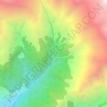
Name: Yamunotri topographic map, elevation, terrain.
Location: Yamunotri, Rajgarhi, Uttarkashi District, Uttarakhand, India (30.97921 78.44270 31.01921 78.48270)
Average elevation: 3,692 m
Minimum elevation: 2,588 m
Maximum elevation: 5,015 m
Thank you for supporting this site ❤️
Make a donation
Make a donation
Gear up for your next adventure:
As an Amazon Associate, this site earns from qualifying purchases at no extra cost to you.