Geolocate

Farellones topographic map

Click on the map to display elevation.

About this map

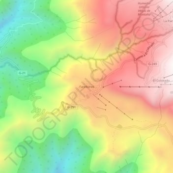
Name: Farellones topographic map, elevation, terrain.

Location: Farellones, Lo Barnechea, Provincia de Santiago, Santiago Metropolitan Region, Chile (-33.37080 -70.33294 -33.33080 -70.29294)

Average elevation: 2,243 m

Minimum elevation: 1,611 m

Maximum elevation: 2,835 m

Other topographic maps

Click on a map to view its topography, its elevation and its terrain.

Gear up for your next adventure:

🧴Bear Spray Holster - Quick-access carry for essential Canadian wilderness safety
🧣Evaporative Cooling Towel - Beat the heat during intense summer climbs
🔦LED Flashlight - Powerful and long-lasting flashlight for camping and emergencies
🥾All-Terrain Hiking Boots - Versatile boots for varied hiking conditions
🗺️Topographic Maps - Detailed maps to explore trails, mountains, and wilderness areas

As an Amazon Associate, this site earns from qualifying purchases at no extra cost to you.