Geolocate

Lambayong topographic map

Click on the map to display elevation.

About this map

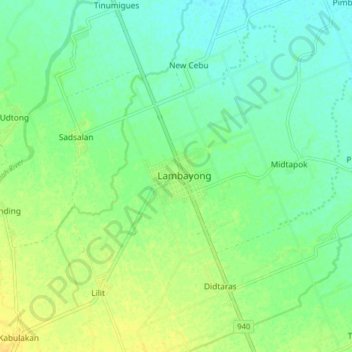
Name: Lambayong topographic map, elevation, terrain.

Location: Lambayong, Sultan Kudarat, Soccsksargen, 9802, Philippines (6.75856 124.59459 6.83856 124.67459)

Average elevation: 25 m

Minimum elevation: 15 m

Maximum elevation: 37 m

Gear up for your next adventure:

🧭GPS Handheld Device - Reliable GPS navigation for outdoor adventures
🌡️Emergency Mylar Blankets - Compact thermal protection for unexpected nights outdoors
🕯️Camping Lantern - Illuminates your entire campsite with high-efficiency LEDs
🧴First Aid Kit - Essential first aid supplies for outdoor emergencies
🥾Trail Hiking Shoes - Durable shoes designed for rugged trails

As an Amazon Associate, this site earns from qualifying purchases at no extra cost to you.