
Saint-Nicolas - Charles III - Ville vieille - Trois Maisons - Léopold topographic map
Interactive map
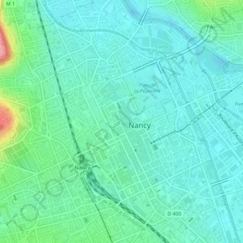
Click on the map to display elevation.
About this map
Name: Saint-Nicolas - Charles III - Ville vieille - Trois Maisons - Léopold topographic map, elevation, terrain.
Average elevation: 213 m
Minimum elevation: 187 m
Maximum elevation: 314 m
Other topographic maps
Click on a map to view its topography, its elevation and its terrain.