Geolocate

Spanaway topographic map

Click on the map to display elevation.

About this map

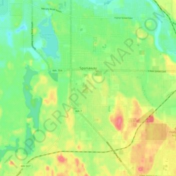
Name: Spanaway topographic map, elevation, terrain.

Location: Spanaway, Pierce County, Washington, United States (47.05334 -122.46399 47.12599 -122.38917)

Average elevation: 119 m

Minimum elevation: 87 m

Maximum elevation: 164 m

Gear up for your next adventure:

🛰️Satellite Messenger - Emergency communication for areas with no cell service
🥽Outdoor Goggles - Protective eyewear for outdoor activities
🥾Trail Hiking Socks - Comfortable socks to prevent blisters and fatigue
🥾Lightweight Hiking Shoes - Comfortable shoes for day hikes
🧥Waterproof Pants - Keep dry during rainy hiking conditions

As an Amazon Associate, this site earns from qualifying purchases at no extra cost to you.