Geolocate

Brandon topographic map

Click on the map to display elevation.

About this map

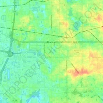
Name: Brandon topographic map, elevation, terrain.

Location: Brandon, Hillsborough County, Florida, United States (27.87890 -82.34383 27.97809 -82.24386)

Average elevation: 19 m

Minimum elevation: 3 m

Maximum elevation: 43 m

Other topographic maps

Click on a map to view its topography, its elevation and its terrain.

FishHawk

United States > Florida > Hillsborough County > Brandon

Average elevation: 24 m

Gear up for your next adventure:

🧊Insulated Water Bottle - Keeps drinks cold in summer and prevents freezing in winter
🧦Merino Wool Socks - Moisture-wicking comfort for long-distance hiking
🧣Evaporative Cooling Towel - Beat the heat during intense summer climbs
🚑Survival Whistle - Signal for help across long distances in mountains
🧦Outdoor Socks - Durable socks designed for hiking and outdoor sports

As an Amazon Associate, this site earns from qualifying purchases at no extra cost to you.