Geolocate

Pai topographic map

Click on the map to display elevation.

About this map

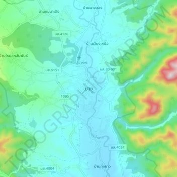
Name: Pai topographic map, elevation, terrain.

Location: Pai, Pai District, Mae Hong Son Province, 58130, Thailand (19.31811 98.40058 19.39811 98.48058)

Average elevation: 605 m

Minimum elevation: 487 m

Maximum elevation: 1,109 m

Gear up for your next adventure:

🔨Vehicle Emergency Tool - Safety tool for remote road trips to trailheads
🚲Handlebar Phone Mount - View topographic-map.com live while cycling
🥾Hiking Boots - Sturdy boots providing ankle support and traction on rugged trails
🧴Insect Repellent - Protect yourself from bugs during outdoor adventures
💡LED Headlamp - Hands-free illumination for night hiking and camping

As an Amazon Associate, this site earns from qualifying purchases at no extra cost to you.